Kona Flood Hazard Map – Flood Risk Assessment Tool
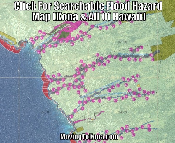
Is Your Kona Property Located In A Flood Hazard? You can enter your exact address, anywhere in Hawaii, and the Hawai‘i Flood Hazard Assessment Tool will indicate where flood hazards exist near you.
 Click For Searchable Flood Hazard Map (Kona & All Of Hawaii)
Kona Annual Rainfall Total: Kailua-Kona receives around 18″ of rainfall per year. Generally, most precipitation events are soaked up by the ground. During tropical storms or severe weather, more rain may fall than the ground can handle and therefore you can receive flooding. The excess rain will follow well-defined water run-off channels.
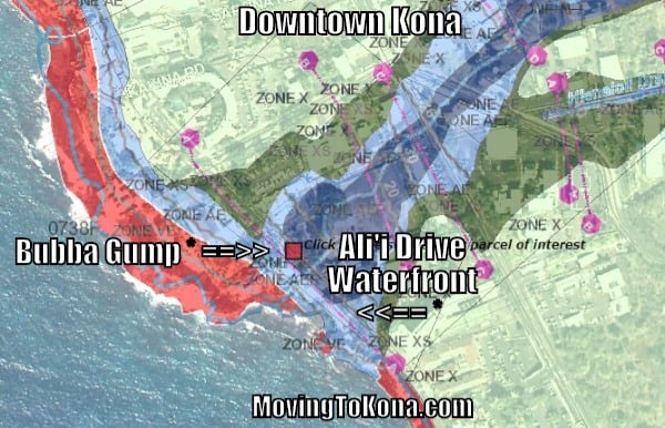
Flooding Risks In Downtown Kailua-Kona: Below is a screenshot of downtown Kona, along Ali’i Drive. You can see how all the water on the side of Mt. Hualalai has to flow downward. (Sorry, Bubba Gump)
Amazon Products
The Hawai‘i Flood Hazard Assessment Tool will provide property owners information when buying or performing repairs or beginning new construction in a Special Flood Hazard Area.
This flood hazard tool will help owners decide whether or not to purchase flood insurance and determine what flood protection measures they may need to utilize.

